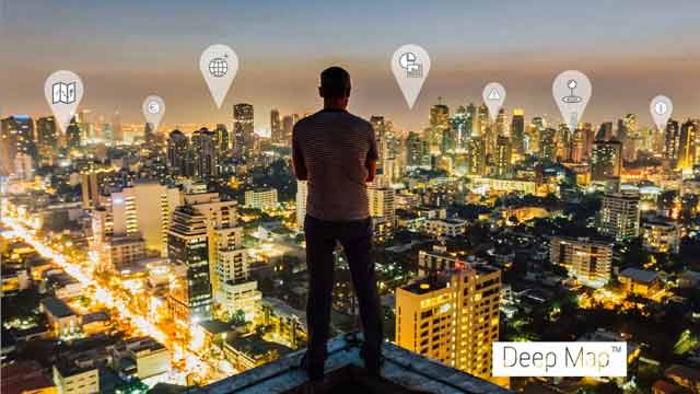

Geodata: the digital resource for new market opportunities
Mobility in Baden-Württemberg and worldwide with Deep MapTM (CeBIT 2017)
In today’s fast-moving, connected world, complex knowledge must be available not only anytime but also anywhere. Wherever they may be, users and systems expect information and services to be precisely tailored to their current location and situation.
Heidelberg Mobil provides orientation for people, objects and processes by clearly displaying and intelligently analyzing abstract geodata. Our Deep MapTM technology can be used as a basis for a wide range of IoT scenarios, delivering answers to critical questions, with direct benefits in terms of time, costs and profitability.
 www.deep-map.com
How do I get to my meeting? Where are my goods? When does this piece of equipment require maintenance? What is the current capacity utilization?
Location information is indispensable for the efficient use of urban spaces for people, the environment and industry. Accordingly, the intelligent use of geodata has huge potential for businesses, especially in conjunction with the IoT, augmented reality and cognitive systems.
Interactive 3D maps help users find their way around complex sites, displaying the shortest route from A to B and saving valuable time. Dynamic route guidance makes it just as quick for customers to find the right product as it is for technicians to locate faulty equipment or hotel guests to find the way to their room.
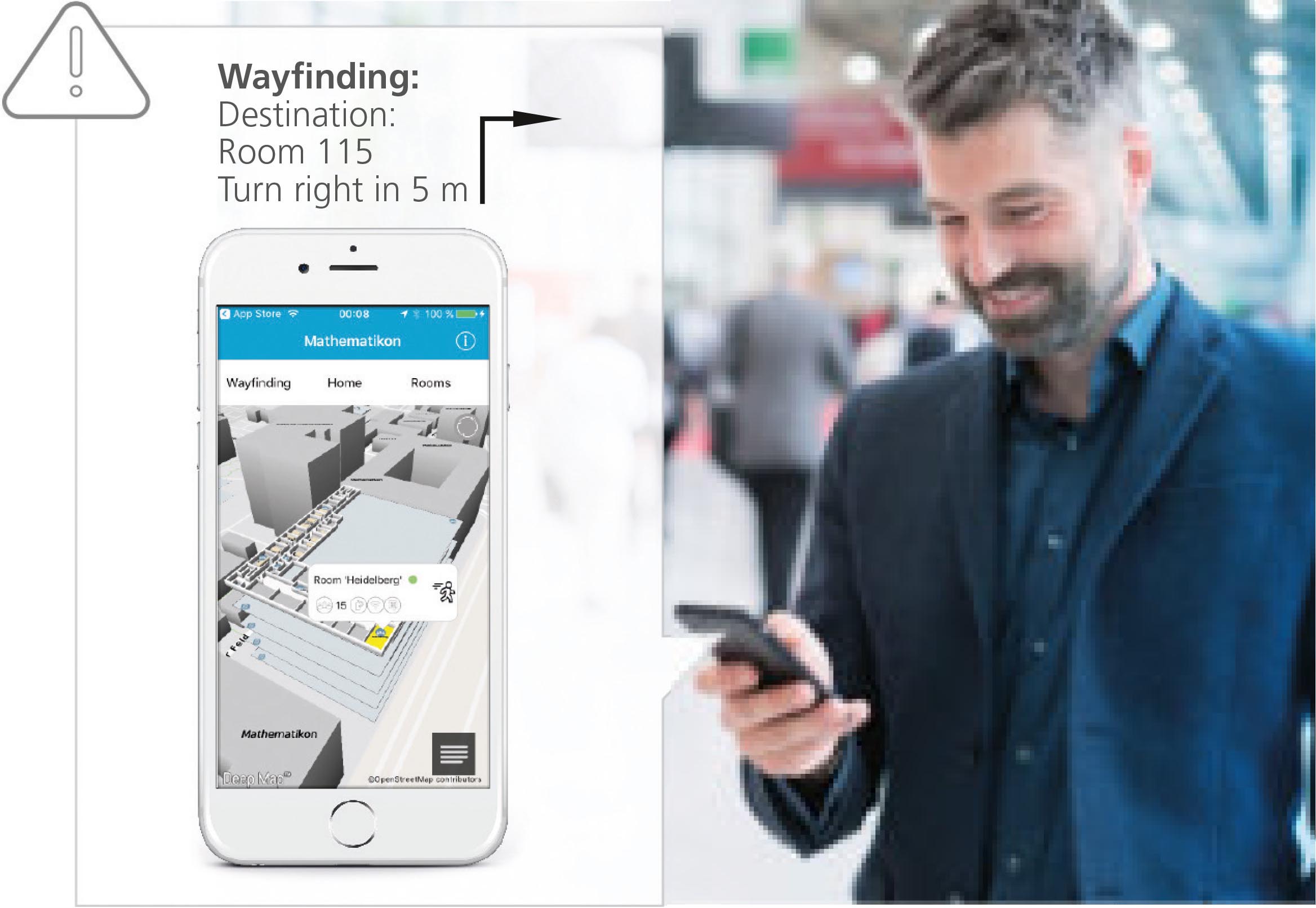
Orientation and wayfinding
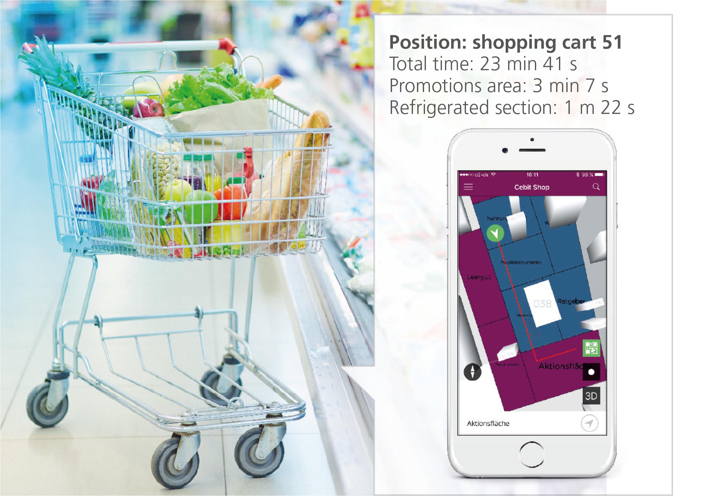
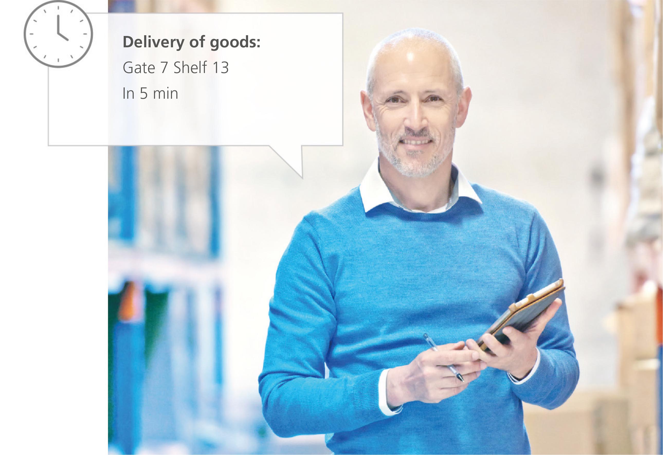
Track and trace
Realtime information
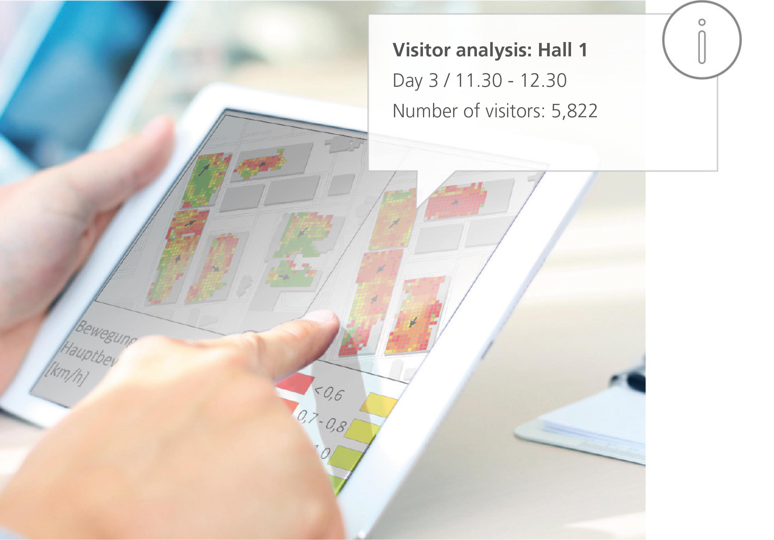
Contextual reporting and analysis
The key to digitally synchronized processes is the ability to track and trace mobile objects. Whether it be shopping carts in the supermarket or technical equipment at a factory, geodata-based Track & Trace boosts efficiency by providing an overview of the whereabouts and status of all kinds of different products, goods and equipment.
Details of the current situation both indoors and out of doors can be displayed dynamically on the map – users can view information about machine faults, room temperature, air quality or occupancy status in real time, resulting in faster and more efficient processes.
In addition, contextual reporting and geodata analysis instantly identify problems such as lengthy periods of downtime or transportation chain disruptions. This information can be fed directly into the planning process, triggering the relevant risk minimization and process optimization measures. By integrating spatial context and situational interactions, Deep MapTM provides the orientation that helps companies from a wide range of industries get to where they want to be.
Heidelberg Mobil International GmbH
Berliner Straße 41
69120 Heidelberg
+49 6221 / 4299 338
info@heidelberg-mobil.com